

Have you ever traveled three hours to see a famous autumn mountain, only to be greeted by stubbornly green leaves or bare, wind-stripped branches?
If you’re planning a trip to South Korea this fall, you’ve probably already Googled the “2026 Korea Autumn Foliage Forecast” and bookmarked a color-coded map. Those maps are great for a rough timeline, but here is a frustrating truth about traveling in Korea during autumn: the official forecast is just an educated guess. A sudden cold snap can accelerate the turning of the leaves by a week, while an unexpected heavy rain can strip a mountain bare overnight.
I learned this the hard way. A few years ago, my wife and I planned a highly-anticipated weekend road trip down to Naejangsan National Park—arguably the most famous autumn destination in the country. The official forecast explicitly stated it was peak weekend. But before hitting the road, I stumbled upon a local trick that completely changed how I travel in Korea.
I didn’t look at the forecast map. I looked at the highway CCTV.
Instead of relying on predictions, I’ll show you exactly how locals check the actual real-time colors using live cams and map apps before they even step out the door.
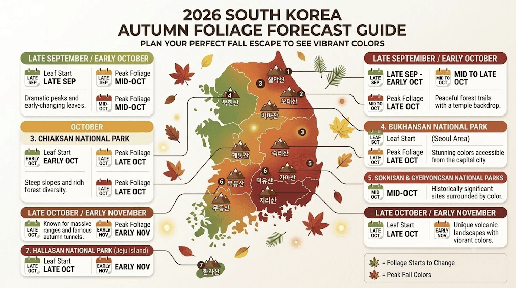
The 2026 Baseline: When Does the Color Actually Change?
Before we get to the live-hack, you still need a baseline. Korea’s autumn foliage moves from north to south, and from high altitudes down to sea level.
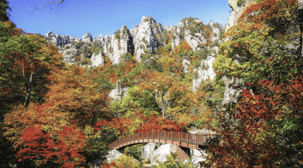
- Early to Mid-October (The North): Seoraksan and Odaesan National Parks usually kick things off. This is when the crisp air first hits the high peaks.
- Late October (The Center): Seoul spots like Gyeongbokgung Palace, Seoul Forest, and Bukhansan hit their prime.
- Early to Mid-November (The South): Southern heavyweights like Naejangsan, Jirisan, and Hallasan on Jeju Island finally turn red and gold.
But remember, this is just a framework. To avoid wasting a whole day of your precious vacation on a poorly-timed hike, you need to verify it.But remember, this is just a framework. To avoid wasting a whole day of your precious vacation on a poorly-timed hike, you need to verify it.
The Local Secret: Naver Map CCTV
This is the single most valuable tip I can give you for autumn travel in Korea. It’s exactly what saved my Naejangsan trip.
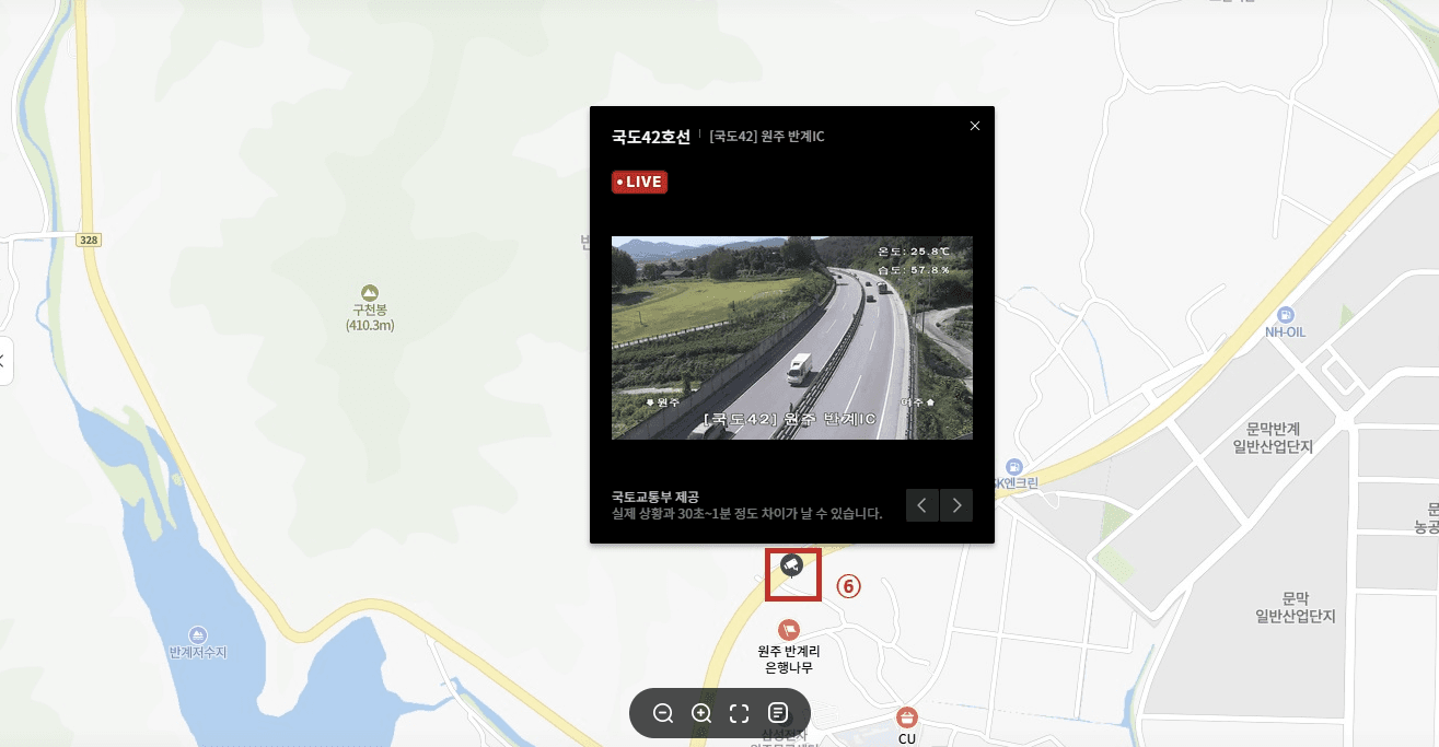
That morning, before driving down, I opened Naver Map to check the travel time. Just out of curiosity, I turned on the CCTV layer and tapped a camera icon located on the main road leading into the national park.
The live video feed popped up on my phone. Not only was there a massive, unmoving line of cars waiting to get into the parking lot, but the trees lining the road were still 70% green. The “peak” forecast was completely wrong for the lower valley. We immediately pivoted and drove to Songnisan instead, where the leaves were perfectly red and the crowds were manageable. It rescued our entire weekend.
How to do it yourself:
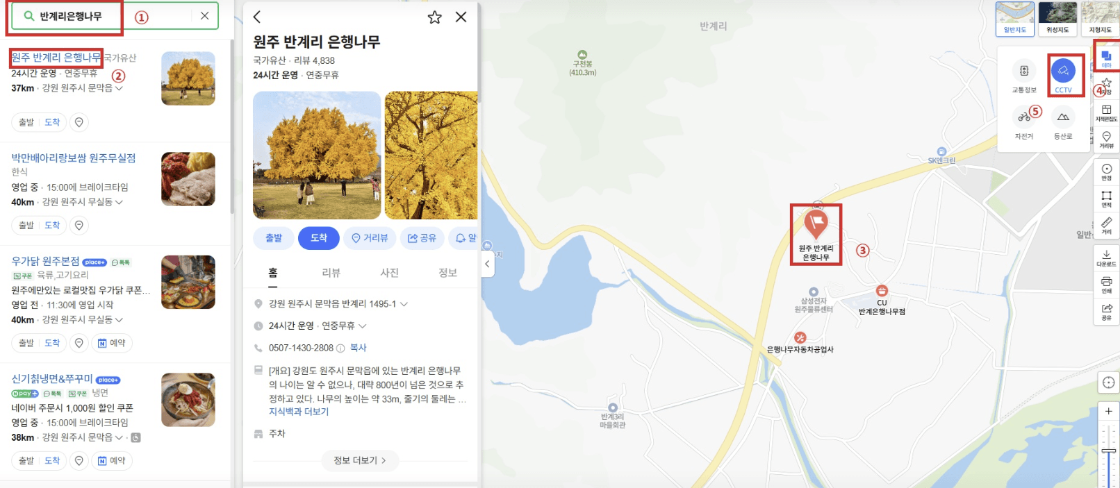
- Download Naver Map and switch the interface to English.
- Tap the two overlapping squares (Layer icon) on the right side of the screen.
- Check the box for CCTV.
- Zoom in on the entrance roads of the mountain or park you want to visit.
- Tap the little camera icons.
You will instantly see a live video feed. Look at the trees on the side of the road. Are they red? Are they green? Are the branches bare? You’ll also see exactly how bad the traffic is—a crucial detail since famous parks get completely gridlocked on weekends.
Checking the Peaks: National Park Live Cams
Naver Map is perfect for checking the valleys and parking lots, but what if you want to know if the actual mountain peaks have changed color?
The Korea National Park Service (KNPS) operates live webcams on the peaks of major mountains like Seoraksan (Daecheongbong Peak) and Jirisan (Cheonwangbong Peak). You can access these streams directly from the KNPS website.
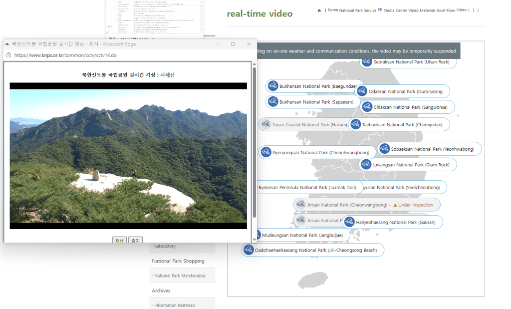
- The Pros: It gives you a literal bird’s-eye view of the high-altitude foliage. Since leaves change at the peak weeks before they change at the bottom, this helps you decide if you need to do a full 4-hour hike to see the colors, or if you can just stroll around the lower temples.
- The Cons: The camera quality isn’t 4K, and if it’s a cloudy or foggy morning, the screen will just be a wall of gray. Still, on a clear day, it’s an unbeatable tool.
The Ultimate Cross-Check: Instagram “Recent” Tags
CCTV works wonders for rural mountains, but it won’t help you much if you’re trying to figure out if the massive ginkgo trees at Sungkyunkwan University in Seoul have turned yellow yet.
For city spots, Instagram is your best live-feed. But do not look at the “Top” posts—those are often heavily edited photos from previous years pushed by the algorithm.
Instead, search a specific location tag (like #SeoulForest or #Naejangsan) and strictly filter by Recent. Look closely at the background of the selfies uploaded in the last 24 hours. Are the trees vibrant? Are people wearing heavy winter coats or light sweaters? This tells you exactly what to expect for both the scenery and the weather.
The Bottom Line: Stay Flexible
The biggest mistake tourists make is locking in a rigid, non-refundable autumn itinerary six months in advance. Nature doesn’t care about your spreadsheet.
If there’s one takeaway from my experiences traveling around Korea, it’s this: build flexibility into your schedule. Wake up, check the Naver Map CCTV, take a quick glance at Instagram’s recent tags, and go where the colors are actually peaking today.
It takes three extra minutes of screen time in your hotel room, but it absolutely guarantees you won’t go home disappointed.
💬 Frequently Asked Questions (FAQ)
Q. When do the autumn leaves start turning in Korea for 2026?
A: This year, you’ll see the first pops of color up north around late September—specifically at Seoraksan and Odaesan National Parks. If your trip falls between late September and early October, don’t wait around in Seoul. Instead, head straight for the higher altitudes in Gangwon-do. A quick ride on the Seoraksan Cable Car during this window is highly recommended to catch the early transformation.
Q. When is the best time to see fall foliage in Seoul (Bukhansan, Palaces, etc.)?
A: In Seoul, places like Bukhansan National Park usually start turning around mid-to-late October, with the absolute peak colors hitting by late October. If you’re on a tight schedule and don’t have time to travel out to the provincial parks, aim for the last week of October. That’s your sweet spot for downtown destinations like Seoul Forest, Gyeongbokgung Palace, and local university campuses.
Q. I’m visiting Korea in November. Did I miss the autumn leaves?
A: Not at all! The cool air sweeps from north to south, so by early November, the southern provinces are putting on a spectacular show. Heavyweights like Jirisan, Naejangsan, and Jeju Island’s Hallasan will be blazing with peak reds and yellows right around this time. You can easily book a KTX train for a day trip or an overnight stay to catch the best of it.
Q. Can I 100% trust the official Korea autumn foliage forecast map?
A: The forecast maps are a fantastic baseline for sketching out your itinerary, but nature rarely sticks to a strict schedule. Altitude, sudden rain, and temperature drops can shift the reality on the ground by days. That’s why I always advise visitors to use the Naver Map ‘Live CCTV’ trick explained in this guide. Do a quick cross-check of the actual trees and parking lot traffic on the morning of your trip before you head out.